Having a look back through the archives and found a few posts from 2006 about fears a Full Moon would cause Mayon Volcano to erupt! Then a few days later Mayon goes quiet. But where is Mount Mayon and what has happened to it over the last 15 years?

What and Where is the Mayon Volcano?
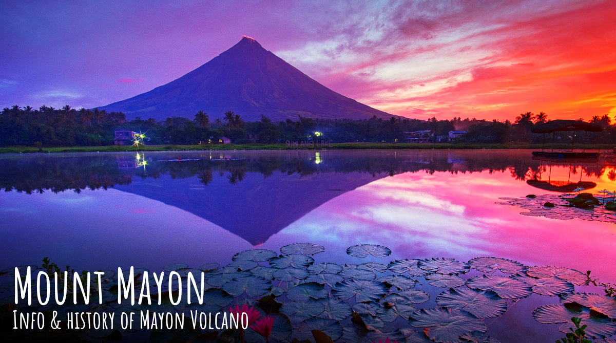
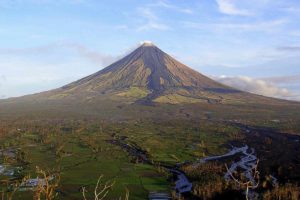
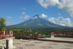
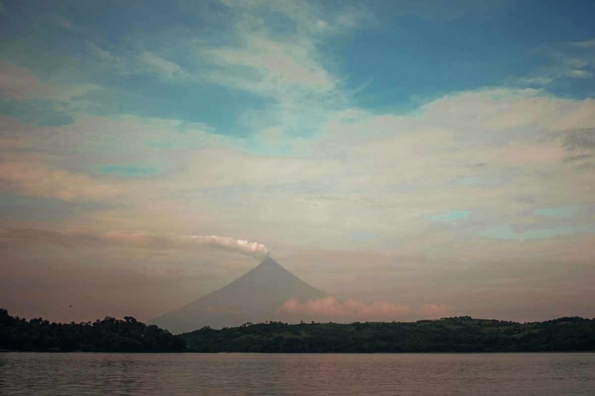
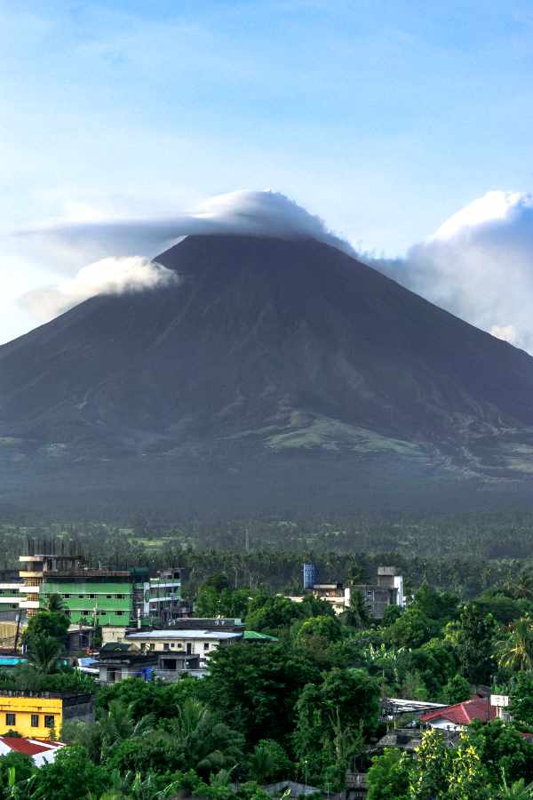
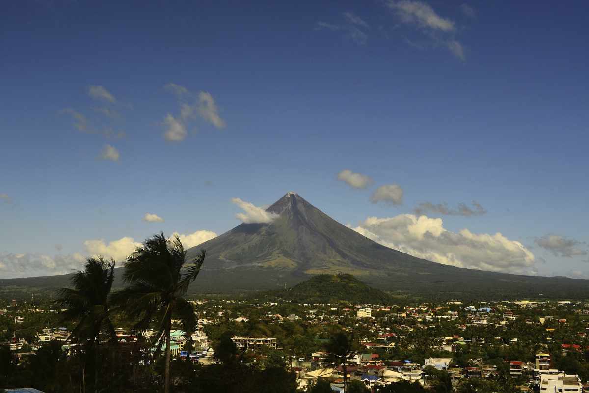
Mayon Volcano, also known as Mount Mayon is a sacred and active stratovolcano in the province of Albay in Bicol Region, on the large island of Luzon in the Philippines. A popular tourist spot, it is renowned for its “perfect cone” because of its symmetric conical shape.
Mythology: It is said that the volcano grew from the burial grounds of lovers Magayon and Panganoron. Thus, the ancient Bicolanos named it after the legendary princess-heroine Daragang Magayon (English: Beautiful Lady). After some time, the volcano was chosen as the abode of the supreme god of the Bicolano people, Gugurang, who also chose Mayon as the repository of the sacred fire of Ibalon. Numerous festivals and rituals are associated with the volcano and its landscape.
The volcano with its surrounding landscape was declared a national park on July 20, 1938, the first in the nation. It was reclassified as a Natural Park and renamed as the Mayon Volcano Natural Park in 2000. It is the centerpiece of the Albay Biosphere Reserve, declared by UNESCO in 2016, and is currently being nominated as a World Heritage Site.
It is the most active volcano in the Philippines, and its activity is regularly monitored by PHIVOLCS from their provincial headquarters on Ligñon Hill, about 12 kilometers (7.5 mi) SSE from the summit.
Location
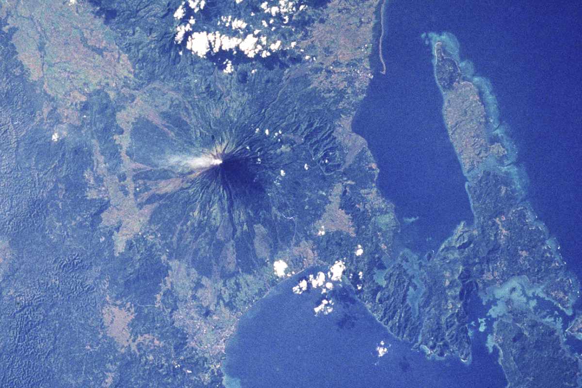
Mayon is the main landmark and highest point of the province of Albay and the whole Bicol Region in the Philippines, rising 2,462 meters (8,077 ft) from the shores of the Albay Gulf about 10 kilometers (6.2 mi) away.
The volcano is geographically shared by the eight cities and municipalities of Legzpi, Daraga, Camalig, Guinobatan, Ligao, Tabaco, Malilipot, and Santo Domingo (clockwise from Legazpi), which divide the cone like slices of a pie when viewing a map of their political boundaries.
Geology
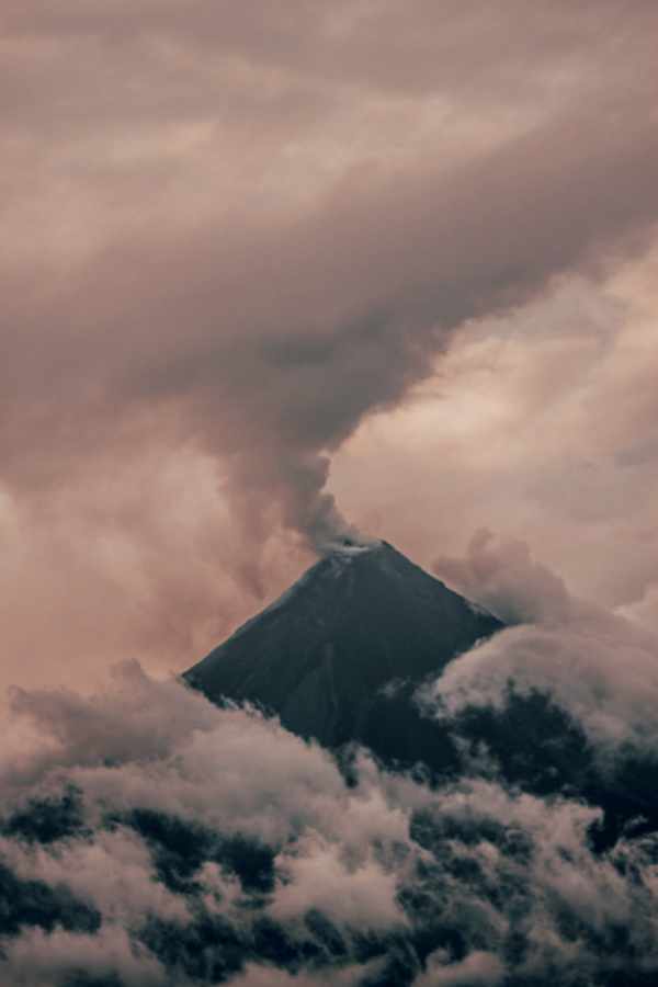
Mayon is a classic stratovolcano with a small central summit crater. The cone is considered the world’s most perfectly formed volcano for its symmetry.
The concave profile, a hyperbolic sine curve of the volcano is due to the balance between erosion and eruption, defined by the angle of repose of ash. The steepest upper slopes of the volcano reach an average slope gradient of 75%, while the lower foot slope is only an average of 3%. The volcanic crater is about 250 m in diameter. At least 85 lava flows have been identified, and consist mainly of ‘A’ā augite-hypersthene-andesite, generally fed from the crater. Pyroclastic flows, characterized as a St. Vincent nuee’ ardente, leave behind block and ash deposits, and breadcrust bombs in an ash and lapilli matrix.

Like other volcanoes around the Pacific Ocean, Mayon is a part of the Pacific Ring of Fire. It is on the southeast side of Luzon. The Bicol Arc is one of 7 oceanic trench subduction zones defining the Philippine Mobile Belt. Volcanism in the Bicol Arc is related to the westward subduction of the Philippine Plate along the Philippine Trench. The 12 active and inactive volcanoes within the arc include the Mayon Volcano, Mount Isarog, Mount Iriga, Malinao Volcano, and Mount Masaraga. In general, these are calc-alkali basalts, basaltic andesites, and andesites.
Recorded Eruptions
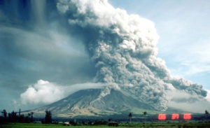
Mayon is the most active volcano in the Philippines, erupting over 47 times in the past 500 years. Historical observations accounted its first eruption in 1616. The first eruption for which an extended account exists was the six-day event of July 20, 1766.
1814 Eruption
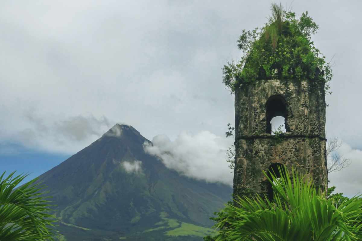
Its most destructive recorded eruption occurred on February 1, 1814. Lava flowed but less than the 1766 eruption. The volcano belched dark ash and eventually bombarded the town of Cagsawa with tephra that buried it. Trees burned, and rivers damaged.
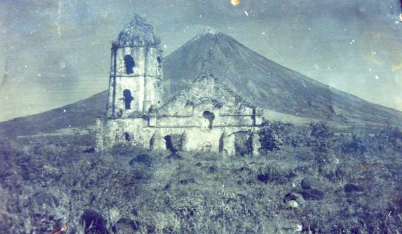
In Cagsawa town, about 1,200 locals perished in what is considered to be the most lethal eruption in Mayon’s history. Opposite is an old photograph of the Cagsawa ruins with the façade still standing. The church was largely destroyed during the 1814 eruption of Mayon. Only the bell tower exists today.
1881–1882 Eruption
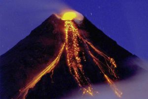
From July 6, 1881, until approximately August 1882, Mayon underwent a strong eruption. Samuel Kneeland, a naturalist, professor and geologist, personally observed the volcanic activity on Christmas Day, 1881, about five months after the start of the activity:
At the date of my visit, the volcano had poured out, for five months continuously, a stream of lava on the Legaspi side from the very summit. The viscid mass bubbled quietly but grandly, and overran the border of the crater, descending several hundred feet in a glowing wave, like red-hot iron. Gradually, fading as the upper surface cooled, it changed to a thousand sparkling rills among the crevices, and, as it passed beyond the line of complete vision behind the woods near the base, the fires twinkled like stars or the scintillations of a dying conflagration. More than half of the mountain height was thus illuminated.
Samuel Kneeland
1897 Eruption
Mayon’s longest uninterrupted eruption occurred on June 23, 1897, which rained fire for seven days. Lava once again flowed down to civilization. Eleven kilometers (7 miles) eastward, the village of Bacacay was buried 15 m (49 ft) beneath the lava. In Santo Domingo 100 people were killed by steam and falling debris or hot rocks. Other villages like San Roque, Sta. Misericordia and Santo Niño became deathtraps. Ash was carried in black clouds as far as 160 kilometers (99 mi) from the catastrophic event, which killed more than 400 people.
1984 and 1993 Eruptions
No casualties were recorded from the 1984 eruption after more than 73,000 people were evacuated from the danger zones as recommended by PHIVOLCS scientists.
But in 1993, pyroclastic flows killed 79[13] people, mainly farmers, during the eruption that also forced 50,000 residents evacuated, according to the Albay provincial government.
1999 Eruption
Mayon began its increasing activity in May 1999, with hazard status associated raised to Alert Level 1. On June 22, 1999, Mayon emitted an ash column that rose to approximately 10 km above the vent; the status was later raised to Alert Level 2. The emission was recorded by the seismic network of the Philippine Institute of Volcanology and Seismology as an explosion that lasted for 10 minutes. No volcanic earthquakes nor other visible signs of abnormal activity were observed before the explosion.
2000 Eruptions
Mayon had experienced continuous emissions since 1999 and followed by a series of eruptions in the next two consecutive years. On January 5, 2000, a 5-km-high ash column was produced by an explosion. Growth of summit-crater dome and intensifying eruptions later signalled evacuations.
Past emissions had led to the growth of the lava dome beginning February 12. On February 23, series of eruptions began. PHIVOLCS then recommended evacuation even beyond permanent danger zone. On February 24, PHIVOLCS raised its status to the highest, Alert Level 5, with at least eight towns and one city warned of possible explosions with ash and lava flows, and several thousands forced to evacuate even outside identified danger zones. The most violent eruptions were occurred from February 28 to March 1, and since then, declining activity was observed until April.
NDCC reported that the 2000 eruption displaced 14,114 families (68,426 persons) and damaged at least ₱89-million worth of property and crops.
2001 Eruption
NDCC reported that another eruption in 2001 that affected 11,529 families (approx 56,853 people) and damaged more property and crops.
2006 Eruptions
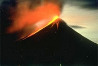
Mayon’s 48th modern-era eruption was on July 13, 2006, followed by quiet effusion of lava that started on July 14, 2006. Nearly 40,000 people were evacuated from the 8-kilometre (5.0 mi) danger zone on the southeast flank of the volcano.
After an ash explosion of September 1, 2006, a general decline in the overall activity of Mayon was established. The decrease in key parameters such as seismicity, sulfur dioxide emission rates and ground inflation all indicated a waning condition. The slowdown in the eruptive activity was also evident from the decrease in intensity of crater glow and the diminishing volume of lava extruded from the summit. PHILVOLCS Alert Level 4 was lowered to Level 3 on September 11, 2006; to Level 2 on October 3, 2006; and to Level 1 on October 25, 2006.
2008 Eruption
On August 10, 2008, a small summit explosion ejected ash 200 meters (660 ft) above the summit, which drifted east-northeast. In the weeks prior to the eruption, a visible glow increased within the crater and increased seismicity.
2009–2010 Eruptions
On July 10, 2009, PHIVOLCS raised the status from Alert Level 1 (low level unrest) to Alert Level 2 (moderate unrest) because the number of recorded low frequency volcanic earthquakes rose to the same level as those prior to the 2008 phreatic explosion.
At 5:32 a.m. on October 28, 2009, a minor ash explosion lasting for about one minute occurred in the summit crater. A brown ash column rose about 600 meters (2,000 ft) above the crater and drifted northeast. In the prior 24 hours, 13 volcanic earthquakes were recorded. Steam emission was at moderate level, creeping downslope toward the southwest. PHIVOLCS maintained the Alert Status at Level 2, but later warned that with the approach of tropical cyclone international codename Mirinae, the danger of lahars and possible crater wall collapse would greatly increase and all specified precautions should be taken.
At 1:58 am on November 11, 2009, a minor ash explosion occurred at the summit crater lasting for about three minutes. This was recorded by the seismic network as an explosion-type earthquake with rumbling sounds. Incandescent rock fragments at the upper slope were observed in nearby barangays. Ash column was not observed because of cloud cover. After dawn, field investigation showed ashfall had drifted southwest of the volcano. In the 24-hour period, the seismic network recorded 20 volcanic earthquakes. Alert Status was kept at Level 2 indicating the current state of unrest could lead to more ash explosion or eventually to hazardous magmatic eruption.
At 8 pm on December 14, 2009, after 83 volcanic quakes in the preceding 24 hours and increased sulfur dioxide emissions, PHIVOLCS raised the Alert status to Level 3.
Early in the morning of December 15, 2009, a moderate ash explosion occurred at the summit crater and “quiet extrusion of lava” resulted in flows down to about 500 meters (1,600 ft) from the summit. By evening, Albay Province authorities evacuated about 20,000 residents out of the 8-kilometre (5.0 mi) danger zone and into local evacuation centres. About 50,000 people live within the 8-kilometre (5.0 mi) zone.
On December 17, 2009, five ash ejections occurred, with one reaching 500 meters (1,600 ft) above the summit. Sulfur dioxide emission increased to 2,758 tonnes per 24 hours, lava flows reached down to 1,500 metres (4,900 ft) below the summit, and incandescent fragments from the lava pile continuously rolling down Bonga Gully reached a distance of 3–4 km below the summit. By midday, a total of 33,833 people from 7,103 families had been evacuated, 72 percent of the total number of people that needed to be evacuated, according to Albay Governor Joey Salceda.
On December 20, 2009, PHIVOLCS raised Mayon’s status level to alert level 4 because of an increasing lava flow in the southern portion of the volcano and an increase in sulfur dioxide emission to 750 tonnes per day. Almost 460 earthquakes in the volcano were monitored. In the border of the danger zone, rumbling sounds like thunder were heard. Over 9,000 families (44,394 people) were evacuated by the Philippine government from the base of the volcano. No civilian was permitted within the 8 km danger zone, which was cordoned off by the Philippine military who actively patrolled to enforce the “no-go” rule and to ensure no damage or loss of property of those evacuated.
Alert level 4 was maintained as the volcano remained restive through December, prompting affected residents to spend Christmas and the New Year in evacuation centers. On December 25, sulfur dioxide emissions peaked at 8,993 tons per day and on December 28, PHIVOLCS director Renato Solidum commented on the status of the volcano, “You might think it is taking a break but the volcano is still swelling.” On the next day December 29, a civil aviation warning for the airspace near the summit was included in the volcano bulletins. The ejected volcanic material since the start of the eruption was estimated to have been between 20 million to 23 million cubic meters of rocks and volcanic debris, compared to 50 million to 60 million cubic meters in past eruptions.
On January 2, 2010, PHIVOLCS lowered the alert level of the volcano from level 4 to level 3, citing decreasing activity observed over the prior four days. The state agency noted the absence of ash ejections and relative weakness of steam emissions and the gradual decrease in sulfur dioxide emissions from a maximum of 8,993 tonnes per day to 2,621 tonnes per day. 7,218 families within the 7–8 km danger zones returned to their homes, while 2,728 families residing in the 4–6 km danger zone remained in the evacuation centers pending a decision to further lower the alert level.
On January 13, 2010, PHIVOLCS reduced the Alert Level from 3 to 2 due to a further reduction in the likelihood of hazardous eruption.
2013 Phreatic Eruption
On May 7, 2013, at 8 a.m. (PST), the volcano produced a surprise phreatic eruption lasting 73 seconds. Ash, steam and rock were produced during this eruption. Ash clouds reached 500 meters above the volcano’s summit and drifted west southwest.
The event killed five climbers, of whom three were German, one was a Spaniard living in Germany, and one was a Filipino tour guide. Seven others were reported injured. The bodies of the hikers were soon located by the authorities. However, due to rugged and slippery terrain, the hikers’ remains were slowly transferred from Camp 2 to Camp 1, the site of the rescue operations at the foot of the volcano. According to Dr. Butch Rivera of Bicol Regional Training and Teaching Hospital, the hikers died due to trauma in their bodies, and suffocation. Authorities were also able to rescue a Thai national who was unable to walk due to fatigue and had suffered a broken arm and burns on the neck and back.
Despite the eruption, the Philippine Institute of Volcanology and Seismology stated that the alert level would remain at 0. No volcanic earthquake activity was detected in the 24 hours prior to the eruption, and no indication of further intensification of volcanic activity was observed, and no evacuation was being planned.
2014 Renewed Activity
On August 12, 2014, a new 30m-50m high lava dome appeared in the summit crater. This event was preceded by inflations of the volcano (measured by precise leveling, tilt data, and GPS), and increases in sulfur dioxide gas emissions.
On September 14, 2014, rockfall events at the southeastern rim of the crater and heightened seismic activity caused PHIVOLCS to increase the alert level for Mayon from 2 to 3, which indicates relatively high unrest with magma at the crater, and that hazardous eruption is possible within weeks.
The rockfalls and visible incandescence of the crater from molten lava and hot volcanic gas both indicated a possible incipient breaching of the growing summit lava dome. On September 15, 2014, NASA’s Moderate-Resolution Imaging Spectroradiometer (MODIS) detected thermal anomalies near Mayon’s summit, consistent with magma at the surface. On September 16, 2014, provincial governor Joey Salceda said that the government would begin to “fast-track the preparation to evacuate 12,000 families in the 6–8 km extended danger zone”, and soldiers would enforce the no-go areas.
On September 18, 2014, PHIVOLCS reported 142 VT earthquake events and 251 rockfall events. White steam plumes drifted to the south-southwest and rain clouds covered the summit. Sulfur dioxide (SO2) emission was measured at a 757 tonnes after a peak of 2,360 tonnes on September 6. Ground deformation (precise leveling and tilt meters) during the 3rd week of August 2014 recorded edifice inflation.
2018 Activity
On January 13, 2018, at 4:21 PM (PST), a phreatic eruption occurred that propelled a grayish steam and ash plume approximately 2500 meters high that drifted to the southwest side of the volcano. The activity lasted approximately 1 hour and 47 minutes and traces of ash fell in Barangay Anoling, Daraga, Barangays Sua, Quirangay, Tumpa, Ilawod and Salugan of Camalig and in Barangays Tandarora, Maninila, and Travesia in Guinobatan. Sulfuric odor was noted by residents of Camalig town proper.
Rumbling sounds were also heard by residents of Brgy. Anoling, Daraga and rockfall events were intermittently recorded. Faint crater glow was first observed at 10:16 PM. The event prompted PHIVOLCS-DOST to raise the Alert Level of Mayon Volcano from Alert Level 1 (abnormal) to Alert Level 2 (increasing unrest). About 40,000 residents were displaced in the resulting evacuation.
On January 14, 2018, Mayon Volcano’s alert status was upgraded to Alert Level 3 (increased tendency towards a hazardous eruption) after 3 phreatic eruptions and 158 rockfall events were recorded. The summit crater also exhibited a bright glow signifying the growth of a new lava dome and the start of lava flows towards its slopes.
On January 16, 2018, the province of Albay declared a state of calamity as lava flows reached the limits of the 6 kilometer evacuation zone.
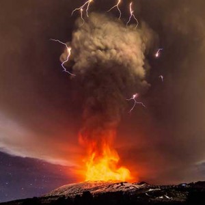
On January 22, 2018, Alert Level 4 was raised after Mayon spewed a 3 kilometer tall ash column at around 12:45 PM. Classes in all levels in private and public schools were suspended in the whole province of Albay. By evening, lava fountains were spewed from the crater with pyroclastic flows and ash plumes. Lava bombs and rockfalls could also be observed and rumbling sounds from the eruptions could be heard. The eruption type was classified as a Strombolian eruption.
On January 23, 2018, Mayon spewed 300 to 500 meter lava fountains and ash plumes with a 4 to 5 hour interval. Lava bombs and rockfalls could also be observed and sounds from the volcano could be heard. Classes in all levels, both public and private were still suspended, work in some places were suspended as well. The danger zone was expanded up to 9 kilometers despite remaining at Alert Level 4 and residents from the expanded danger zone were evacuated.
On January 24, 2018, column of ashes and lava fountains were spewed again with an interval of 4 to 5 hours. Fire bombs and rockfalls could also be observed and sounds from the eruptions could be heard.
On January 25, 2018, column of ashes and lava fountains were spewed again. Fire bombs and rockfalls could also be observed and sounds from the eruptions could be heard. The eruptions had an interval of 3 to 5 hours.
Alert Level 4 was maintained at the volcano for the rest of January and all throughout the month of February as it remained restive. On March 6, 2018, after observing a decline in volcanic activity, PHIVOLCS-DOST downgraded the alert level back to Alert Level 3. On March 29, 2018, after observing a further decline in activity, PHIVOLCS-DOST lowered the alert level back to Alert Level 2 signifying the end of Mayon’s eruptive activity and the volcano’s decline to a moderate level of unrest.
On December 26, 2018, Mayon caused two phreatic explosions but maintains Alert Level 2.
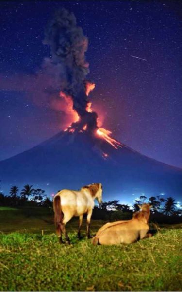
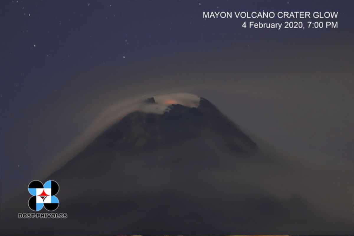
2020 Crater Glow
On the evening of February 4, 2020, the Philippine Institute of Volcanology and Seismology (PHIVOLCS) reported to the public that the crater of Mayon Volcano started to glow up which they say is magma which was still present slightly underneath the surface of the volcano.
Even though this phenomenon alerted the officials and the public, the Mayon Volcano remained at an Alert Level 2 out of 5.
2022 activity
On October 1, Mayon has released 391 tons of sulfur dioxide, and its edifice is also slightly inflated.
A faint crater glow is observed at the summit of the Mayon Volcano, the Philippine Institute of Volcanology and Seismology (PHIVOLCS) said on Wednesday. PHIVOLCS said that it has produced one volcanic earthquake in the last 24-hour observation period. Plumes were also seen drifting west-northwest and westward.
On October 7, The status of the Mayon Volcano in Albay was raised to Alert Level 2 by State volcanologists, due to exhibiting “increasing unrest” as stated.
Source: Wikipedia ~ last updated 23rd September 2020